Wednesday, August 5, 2015

Springing Through Changes


Springing Through Changes
May 17 18, 21 and 31, 2015


        May 18

 May 31


At Cottonwood Pond, mid to late May was a time of growth and blossoming, literally and figuratively. Lush, green growth developed all around the pond area and up to the edges, as well as on the Root Ball, and even in the middle of everything. Some flowers were blooming, some plants were quickly gaining in height, and some new ones were emerging.

We had been through periods of continuous, heavy rains, and some storms, with one period in the middle with little or no rain. This caused water levels to fluctuate, affecting everything in and around the water, changing the nature of the whole area. When water receded, conditions allowed some plants and animal life to move back into spots that were formally underwater, either taking hold or staying temporarily, altering those places in some way. When water returned, it rejuvenated the spots that filled. I do not think anything ever completely dried up during May, so anything staying there had to love dampness.

Overall, the whole area has been changing a great deal, intensified by rains and flooding. The main pond, “little pond”, spaces around the Inlet, the Swampy Spot and all other swamped areas, and the Cove have been working towards becoming one whole, continuous very wet area. Whether that will become one big pond (with the Root Ball in the middle) or just one big, flat swampy area remains to be seen.

I will first describe general observations of three visitation periods: May 17 and 18, May 21, and May 31. After that, we will go on a photographic journey of comparisons in different locations of the area in the bottom of my woods that I call Cottonwood Pond.

(Note: the previous blog entry, Maps II, can work as a good reference, especially if you are new to this blog and place. You might even enjoy going backwards, reading blog entries from the beginning, to get a sense of how things started and how much they have changed.)

May 17 and 18 – after periods of heavy rains

–        Butterweed in bloom around area
–        Jewelweed plants growing
–        “Mystery Plants” (which could be a species of Monkeyflower) are growing in more areas, other than the Swampy Spot, such as in the soggy area outside the Inlet, and shallow places in the Creek
–        Plants in the main pond water are still green
–        There is a great deal of greenery around the Root Ball and on the Mud Piles
–        Swampy areas are all around.
–        The Cove is larger and easy to see through
–        Lots of water in the Seep
–        The Dam (zig-zag) area in the Seep has Crawdad chimneys on it (possibly raided by Raccoons.)
–        The vertical space at the Inlet, between the main pond water and the Barkless Log over it is much larger; the space is complete – one whole Inlet

May 21 – after a short period of little or no rain

–        Butterweed is in bloom
–        Plants growing: Jewelweed, Clearweed, grasses
–        Poison Ivy vines hanging from the top edge of the Root Ball
–        Everything is very wet and muddy, but:
- main Pond is lower
- no water in the Seep
- no water over the Isthmus
–        Water is very clearly moving through the Cove
–        A much wider space at the Inlet (between pond surface and Barkless Log) since water level has gone down

May 31 – more heavy rains since mid-May

–        Very dense greenery on top of Root Ball, on Mud Pile #1, and all around
–        The Cove is widening
–        Water moving through the Cove to “little pond” area (not sure if it moves both ways)
–        The main pond is still full, but not at a high level


Photographic Journey of Comparisons in mid to late May:

Whole area, viewed from the north:

 May 17

Left to right:  “little pond” with Trunk in background; Two-Trunk Tree (only one trunk visible) and Root Ball with Mud Pile #1 and Isthmus between; main Pond – Seep coming from right corner; Barkless Log above Inlet in background, with Bent Blue Beech above and Very Rotten Log below right.  Masses of Jewelweed plants on the ground, interspersed with groups of Stinging Nettle. Yellow flowers are Butterweed. Creek, not very visible here, is to far right. “little pond” has swollen into a swampy area nearby, has gone under the Trunk, and has joined the main Pond water through the Cove (not visible here) under the Root Ball.


 May 18

Same view, closer: much dirt has sloughed off the bottom side of the Root Ball onto  Mud Pile #1, which is covered in plants, and which extends across to the Two-Trunk Tree (which is in the foreground.) This behaves as a sort of dam between the main Pond and “little pond”, but as an Isthmus when there is enough water to flow over it. The stretching out of “little pond” can be seen more clearly here (on the left.) The Cove is barely seen under the Root Ball on the main Pond side, but the Inlet is very clear (back right.)

Views of the main Pond:

 May 17

North end, looking from south – north edge of main Pond where it meets with “little pond” over the Isthmus when water is high. Water also overflows into the Seep at the left corner (empties into the Creek.) Mud Pile #1 is seen on the right, below the Root Ball.


May 17

Looking to the south along the edge of the main Pond during inundation. In the background the Very Rotten Log can be seen going under the Barkless Log, with a very clear Inlet.


 May 17

Closer view of Barkless Log, Inlet and Very Rotten Log at the southeast end of the main Pond. Formerly, water seeped in via 2-3 small inlets under the Barkless Log.


 May 17

The Main Pond during a deep period. The Cove can be clearly seen at the base of the Root Ball, where water now flows between sides. Also visible are Mud Pile #1 (left) and the smaller Mud Pile #2 (at the right,      nestled between the Root Ball base the Barkless Log/Inlet).

May 21
Four days later, water has receded to some degree. It no longer extends beyond the small tree on the right. As the overall water level is lower, the space in the Inlet is much larger.
Mud Pile #1:

 Plants growing on Mud Pile #1: Jewelweed, with and understory of Clearweed

The Seep

May 17: the corner of the main Pond (left) emptying to the right into the Seep after heavy rains.
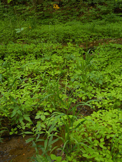

              May 17: though barely visible through cover of Jewelweed, grasses, Poison Ivy and other plants, the Seep winds from the Pond (bottom) to the Creek (top)


May 18: where the Seep zig-zags in the middle of its journey, a dam has been developing - Crawdads have been building their chimneys in the mud there, building up the dam

May 18: a Raccoon print in the mud by Crawdad chimneys in the dam - the chimneys are collapsed from either heavy rains or raccoon raids
 
 
             May 18: Where the Seep meets the Creek (near the other end of the Very Rotten Log), a bark piece has been exposed. Water trickles over the bark during and after heavy rains
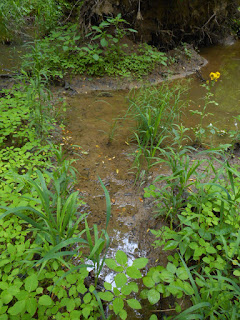

            May 18:  Another look at where water leaves the Pond corner (top) and flows down the Seep


 May 21:  Four days later, water has receded, though everything is still very muddy - the main Pond water (below) is lower - no water flows through the Seep (left) or over the Isthmus (upper right), but there are many Raccoon prints

 
The Isthmus

May 17: After heavy rains, water is moving over the Isthmus from the main Pond (below) to “little pond”

“little pond”


May 17: looking across “little pond” toward the Trunk after much rain - water can be seen extending to the other side of the Trunk as well as across adjacent land to the left, creating a generally soggy, almost swampy area


May 21: After a period of little or no rain, the water of “little pond” has receded, but still extends beyond the Trunk - the deep part is distinguishable


The Temporary Creek


May 18: The Temporary Creek is where water collects at the base of the slopes to the east/northeast of Cottonwood Pond and flows down to the eastern end of the area, under the Trunk to “little pond” as well as under the Inlet into the main Pond - a walk eastward along the slopes reveals the upper, farthest reaches of Temporary Creek (which is roughly parallel to the regular Creek)

Swampy Spots

 Water flows from the Temporary Creek (upper right) into soggy “swampy” areas on the eastern edge of the Cottonwood Pond area - here, a large clump of “Mystery Plants” (which may be a species of Monkey Flower” grows in a perennially wet spot


Just outside the Inlet, water originating from the Temporary Creek gathers into another very soggy area - here, the same “Mystery Plants” have recently taken hold, finding this wet place favorable - they also grow in some shallow places in the Creek

A Closer Look at Water in the Main Pond:

May 17: After heavy rain, unidentified plants in the main Pond water are still green and growing … 


… while fallen Tulip Tree blossom petals gather at a nearby corner, by the Very Rotten Log


May 21:  With a lower water level four days later, it is easier to see algae and detritus on the bottom of the main Pond


Life around Cottonwood Pond

 Jewelweed plants and fallen Tulip Poplar blossom petals on the mud - dark streaks are rotten leaves from the year before.   

 Tiny orange fungi (above Tulip Poplar petal), encouraged by much moisture, on the Very Rotten Log


 A carpet of young Jewelweed plants and some tall Stinging Nettle plants surround the Very Rotten Log - the log extends over the Creek near a blossoming yellow Butterweed


May 21:  A Spicebush shrub, planted a few years ago (and tagged with pink tape) is flourishing near Cottonwood Pond  


 May 18

May 31


Observations after that time (seen only from above at woods edge – no direct visits):

–        There was one period without rain for a while – the main pond receded to a large puddle, in the deeper, south end.
–        There was a great deal more rain before and after that period during which pond levels were high again.


Maps II


Maps  II
2015

I started watching and studying this place, which I named Cottonwood Pond, back in early 2013, to see if a real pond would form, and how it would form. The most interesting aspect of this has been watching the various changes that have occurred there, some unpredicted, and trying to determine how they came about.

I first did a blog entry called “Maps” in April of 2014 as a way to give the reader (and maybe also myself) more perspective on what I'd been talking about for over a year. So much has happened since that time – so many changes. In March of this year, I wrote an entry called “Vocabulary”, since new spots had developed at Cottonwood Pond, and some of the old spots I had been referring to had disappeared or changed greatly. It was time to put it all down for the reader – the terms I was using and what they referred to.

Now it is time to do a new entry of maps, because the landscape of Cottonwood Pond looks so different 15 months later. Largely, the area has become “swampier” whenever there has been ample rain. Though this area is part of a long, wide floodplain on either side of the Creek, nestled between the slopes of my woods, over time water has tended to pool more around Cottonwood Pond. Sometimes the water has no boundaries around the Trunk, which can appear as an island in the middle of a big swampy, pond-y place. Water has carved out an area below the trunk (the Cove) where it flows back and forth, and it has carved out a larger space (the Inlet) below an old fallen tree at the edge of the pond (Barkless Log), allowing more water to flow into the pond after heavy rains, and for more to collect in the muddy perimeter.

I am presenting four maps, three of them from different approaches anyone might take to the pond, and another as an overhead, bird's-eye view, for overall context. These are just rough, schematic sketches. They are definitely not to scale.

From my writings and photos throughout my blog, you will have to imagine the filled-in spaces. What looks like a blank space on a map may actually be dense with Jewelweed and other plants in the summer, or may be full of mud or ice in the winter. You will have to imagine frogs, snails, Water Striders and Backswimmers in the water, and the Root Ball Top full of vegetation, with maybe birds landing within, spider webs stretching between rootlets, or a snake coiled at the top. You will have to imagine the sounds around there – birds singing, woodpeckers knocking on trees, sweeps of cicada choruses, and the musical scrapings of katydids after dark. You will have to imagine scores of raccoon footprints in the mud all around, thin lines in the mud left by worms and a thick one left by a snake, and maybe a print of a deer, coyote or opossum.

Water levels can change drastically. On all of the maps, these lines: -------- indicate places where water sometimes extends.

I hope that these maps will help you see Cottonwood Pond more clearly, and will be a good reference when you are reading my descriptions and looking at my photos in various entries before and after this.

Birds-Eye View – an Overall Look at Cottonwood Pond and its Environs:


BBB – Bent Blue Beech – a live young tree that became bent when the Cottonwood fell.
BE – Boxelder sapling
BKL – Barkless Log, including Lower and Upper (the main trunk of this old fallen tree lies across the edge of the pond - after the Root Ball, it divides into two large limbs, one along the ground, the other extending upward)
Cr – Creek
EB – Elderberry shrub group
Isth – Isthmus (after much rain) – where water flows between the main pond and “little pond”.
l.p. - “little pond”
MP #1 and #2 – Mud Piles
P – main Pond
RBB – Root Ball Bottom (the part that was in the ground when the tree was standing)
RBT – Root Ball Top (the part that was  soil level)
S – Seep (water seeps from the corner of the pond down to the creek - where it meets the creek, there is a little bark ledge that was exposed earlier this year.)
SL – Slope
SS – Swampy Spot (the original “swampy place”, before the whole area would flood – it formed at the end of Temporary Creek #1)
T – Trunk of the fallen Cottonwood
TC #1 and #2 – Temporary Creek: #2 became evident early this year and is, so far, more intermittent than Temporary Creek #1 - both form from water that seeps down the slopes.
2TT – the 2 Trunk Tree, which is probably a White Ash. Water sometimes gathers around it.
VRL – Very Rotten Log – extends over the creek, across muddy ground and then under the Barkless Log, after which it gradually disappears into the ground from increased rotting.
YT – Young Tree – sometimes outside the edge of the pond, sometimes growing out of the water.

So, here it is – Cottonwood Pond and its environs. The slopes to the southwest go up to the yard and house. It is this slope that I most often descend to reach the pond. It is from the top edge of this slope that I look down, take the faraway photos, and from where I get my only view of the pond when I  short of time, on crutches, or things are way too slippery.
The slopes to the northeast are roughly in the middle of the woods, though parts of them extend to the other edge, where there is a farm field beyond our border. During heavy rain, water flows, though imperceptibly, down to the bottom of the slope, where it gathers and flows toward Cottonwood Pond as “Temporary Creek”. TC#1 shows signs of becoming permanent.
Between the slope areas is a wide flood plain through which the Creek winds. The floodplain is very thick and rich with plant life during the summer after the slopes have become practically bare (the slopes are very thick with plants all spring.) The Creek tends to be always flowing, though the water can vanish during a very dry summer. It begins somewhere to the southeast, beyond our road. It flows through a culvert under the road and dumps down into our woods, where it flows in a roughly south/southwest direction until it gradually turns roughly west/northwest, and turns westerly well beyond the Cottonwood Pond area.
In the center of the map is the Root Ball, with top and bottom designated. The original, main Pond formed below the bottom, where the Root Ball had lifted out of the mud. On the other side, the Trunk extends above the ground, then up the slope to where it lodged in the fork of a Red Oak tree at the top of the slope.
The place I call “little pond” is much more intermittent than the main pond. It forms, periodically, in the angle between the Trunk and Root Ball Top.


Approaching from the South West:

  
BBB – Bent Blue Beech
BK L – Barkless Log
BL – Bark Ledge – exposed where the Seep meets the Creek
Cr – Creek
CV – Cove (under the Root Ball)
D – the deepest part of the Pond
I – Inlet under the Barkless Log, at the edge of the Pond
Isth – Isthmus (during heavy rains)
l.p. - “little pond” - only visible from this angle when it is swollen from heavy rains
MP #1 and #1 – Mud Piles – formed from mud fallen from the Root Ball, and some soil pushed from the action of water during heavy rains
MS – Maple Sapling at summit of Root Ball (this is where the water snake was seen in May 2014 – see “A Visit to the Pond with Cherie”)
S – Seep
2TT – 2-Trunk-Tree (probably a White Ash)

This is what you see if you come down the slope (from our yard and house) and approach the main Pond. You have to get across the Creek first, of course. If conditions are muddy, I balance along the top of the Very Rotten Log. However, as it gets more rotten (expedited by the great amount of rain we have had this year), this gets chancier.  As you approach the Pond you see the wall of rootlets in back that is the Root Ball Bottom, the Maple Sapling growing from the top (among many other plants), and the little Cove that has formed on the bottom right, where water goes through. You will see the big Mud Pile #1 on the left, covered in plants during the growing season, and the Isthmus between it and the 2-Trunk-Tree (White Ash). You will see the Seep flowing from the left corner down to the Creek, near the Very Rotten Log. You will notice the big space between the water (or mud) and the Barkless Log, which I call the Inlet. You will see the young Bent Blue Beech, with its muscle-like, gray bark, bent toward the Root Ball, and the Young Tree growing at the edge of the Pond. You will see where the Creek flows under the Barkless Log, sometimes with a pool of water to the side.

Approaching from the North West: a side view including the main Pond and “little pond”:


 BBB – Bent Blue Beech
BE – Boxelder sapling
BK L – Barkless Log (main trunk and upper limb seen here)
CV – Cove (opening under the Root Ball)
D – deepest parts of main Pond and “little pond”
I – Inlet under the Barkless Log at the edge of the main Pond
Isth – Isthmus (during heavy rains)
l.p. - “little pond”
MP #1 and #2 – Mud Piles – formed from mud fallen from Root Ball, and sediment pushed by water during heavy rains
MS – Maple Sapling at summit of Root Ball
RBB – Root Ball Bottom
RBT – Root Ball Top
S – Seep (from corner of main Pond to Creek)
T – Trunk of the fallen Cottonwood tree
2TT – 2-Trunk-Tree (probably White Ash)
VRL – Very Rotten Log
YT – Young Tree at edge of main Pond

This is what you see if you move to the edge of the Root Ball on the North West side. You can see both sides of the Root Ball, also seeing the differences between them. You are also able to see both the main Pond and “little pond”. If there has been heavy rain, you would have to be here wearing tall rubber boots, as this whole area gets very soggy.
Some wildlife, such as Coyotes, like to skirt the pond area around this way, when things are not soggy. Raccoons, however, will go almost anywhere.
The Cove has opened up under the Root Ball. From this angle, you can barely see it on the Root Ball Bottom side. The other side of the Cove is not visible from here, as it is blocked from view by the Trunk.
From this direction you can also clearly see the Inlet between the water surface and the Barkless Log, sometimes with sunlight shining through. You can also see the dramatic, graceful arc of the Bent Blue Beech over the far end of the main Pond.

Approaching from the South East, on the other side of Cottonwood Pond:


 BBB – Bent Blue Beech
BK L – L, U – Barkless Log – the main log, plus the Lower and Upper limbs
Cr – Creek
D – deepest part of the main Pond
I – Inlet – water flows into the Pond, under the Barkless Log
l.p. - “little pond” - not visible from this direction, but on the map for reference
MP #2 – Mud Pile #2 – in the angle between the Root Ball Bottom and the Barkless Log – formed by mud dropping from the Root Ball, but also from the action of water pushing sediment and collecting.
MS – Maple Sapling on the summit of the Root Ball
RBB – Root Ball Bottom – originally underground
RBT – Root Ball Top – originally at soil level
S – Seep – barely visible from this view
SS – Swampy Spot (the original swampy place)
T – Trunk of the fallen Cottonwood Tree
2TT – 2-Trunk Tree – a little visible from this angle – at the other edge of the Root Ball
VRL – Very Rotten Log (disappears into soil beyond Barkless Log)
YT – Young Tree growing at edge of main Pond

From this approach , the opposite of the previous one, you can see a very different view. During heavy rains, water comes down the slopes to the east/southeast and collects in the Swampy Spot, in which grow the Mystery Plants. Water then spreads out to go beneath the Barkless Log (Lower) and the Trunk, sometimes also spreading into the area beyond and meeting up with “little pond.” It also flows to the left, eventually flowing through the Inlet into the main Pond. Needless to say, this is another very soggy area where one needs tall rubber boots to explore.
The deepest part of the main Pond is near, so even during dry periods you can peek over the Barkless Log and look into the water, even if it is just a big puddle at the time. You can also get another view of various frogs in the summer, which like to poke their heads out of the water or slip into the Cove to hide in the dark, among rootlets.
You are much closer to the Bent Blue Beech and the Young Tree, where you can observe their green leaves in the summer, their colorful leaves in the fall, and their seeds and flowers, as well as the difference in bark texture.
If you can step over the Lower limb of the Barkless Log and under the Upper (sometimes I have to cross further to the right), you can go peek at the Root Ball Top side of the Cove (and maybe startle some frogs that thought they were hiding from you.) That space is wedged in between the Trunk, Root Ball Top and Barkless Log, so some creative bending is required.

**********************************************************************************

Well, I hope this has brought Cottonwood Pond to life for you even more than usual. This entry can be used as a reference when you are reading another and wonder what in the world I am referring to. So, use your imagination to fill in the spaces while reading my blog and looking at my photos of Cottonwood Pond throughout the seasons.